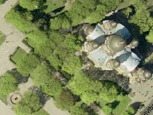
Aerial photography of Riga has been initiated
Aerial photography of Riga and its territory has begun on the 1st of May. This is being undertaken for the necessities of the Riga Municipality and will considerably facilitate work, related to planning, building and analysis of the geographical information of Riga’s territory.
The last time the capital of Latvia was photographed for this aim was in 1999.
The high-resolution photomap obtained will be accessible to every interested person in the Geographical Information System of Riga on the Internet at – www.rigis.lv Every day the Municipality of Riga as well as other authorities and enterprises will be able to use this map, realizing projects related to the land of the Self-government of Riga planning and development, as far as analyzing geographical data of Riga.
Riga City Council Information Technologies Center’s director Eriks Zegelis: “Riga has been developing and changing very quickly since 1999, thus, now the map older than 8 years old serves as an approximate descriptive material. There are more than 7000 new buildings and structures built in Riga since the year 2000. However presently accessible aerial photos lack such buildings as the City Hall, Hansabanka administrative building, reconstruction of railroad station area et al, strategically important buildings of the city”.
By means of the Geographical Information System of Riga it is possible to find the necessary for you objects by names of streets and addresses, municipal, educational establishments, tourist and other objects, as far as represent their location on the city map, to see the red lines of Riga and use much more other possibilities, related to territory of Riga for personal and professional aims.
Riga City Council City Development Department and Riga City Council Information Technologies Center have entrusted the aerial photography of Riga to GEODIS BRNO (Czech Republic) in collaboration with LIVLAND LTD. (Latvia), that have won the opened competition. In general 5 companies took part in this competition – BLOM KARTTA OY (Finland), FM-INTERNATIONAL OY FINNMAP (Finland), GEODIS BRNO in collaboration with LIVLAND LTD, FIT CONSEIL (France) and METRUM LTD. (Latvia). The most economic advantageous and cheapest one was GEODIS BRNO LTD. and LIVLAND LTD. tender – LVL 52 536.00. The most expensive offered tender of the competition was LVL 104 784.00.
Additional information:
Gunars Klegers,
Riga City Council Information Technologies Center
Public relations consultant
Telephone: 67686516
e-mail: gunars.klegers@medijutilts.lv


